Release of GST 3.4
März 18, 2020 6:20 p.m.GiGa infosystems and its team is happy to announce the release of GST 3.4.
This post gives you an overview of the new features and improvements of GST 3.4. Go ahead and try it yourself in our interactive Demo.
The major features and improvements on GST Web are:
- Web Cache, Templates, Admin GUI
- GUI Improvements
- Models of Interest
- Query Tool
- WMS Refinement
- Address Search
- Cadastre Search
- Discrete Color Maps
- GST Boreholes
- Complete List
The major feature and improvements on GST Desktop are:
- Query Feature per polygon
- Change Owner of MoMa Element or Feature Class
- Snapshot of Feature Class
- Snapshot of Feature Selection
- Improve Feature and Feature Class View
- Color Maps for discrete Feature Properties
- Alias for Feature names
- Grid Shift Files in SRS Definitions
- Transform SRS of Feature Class
- Features with Z-Axis Domain in Time
- Smaller Improvements
- Complete List
If you have any questions, please do not hesitate to contact us. We are happy to discuss any features and ideas with you.
Web Cache, Templates, Admin GUI
We improved the overall administrative GUI: 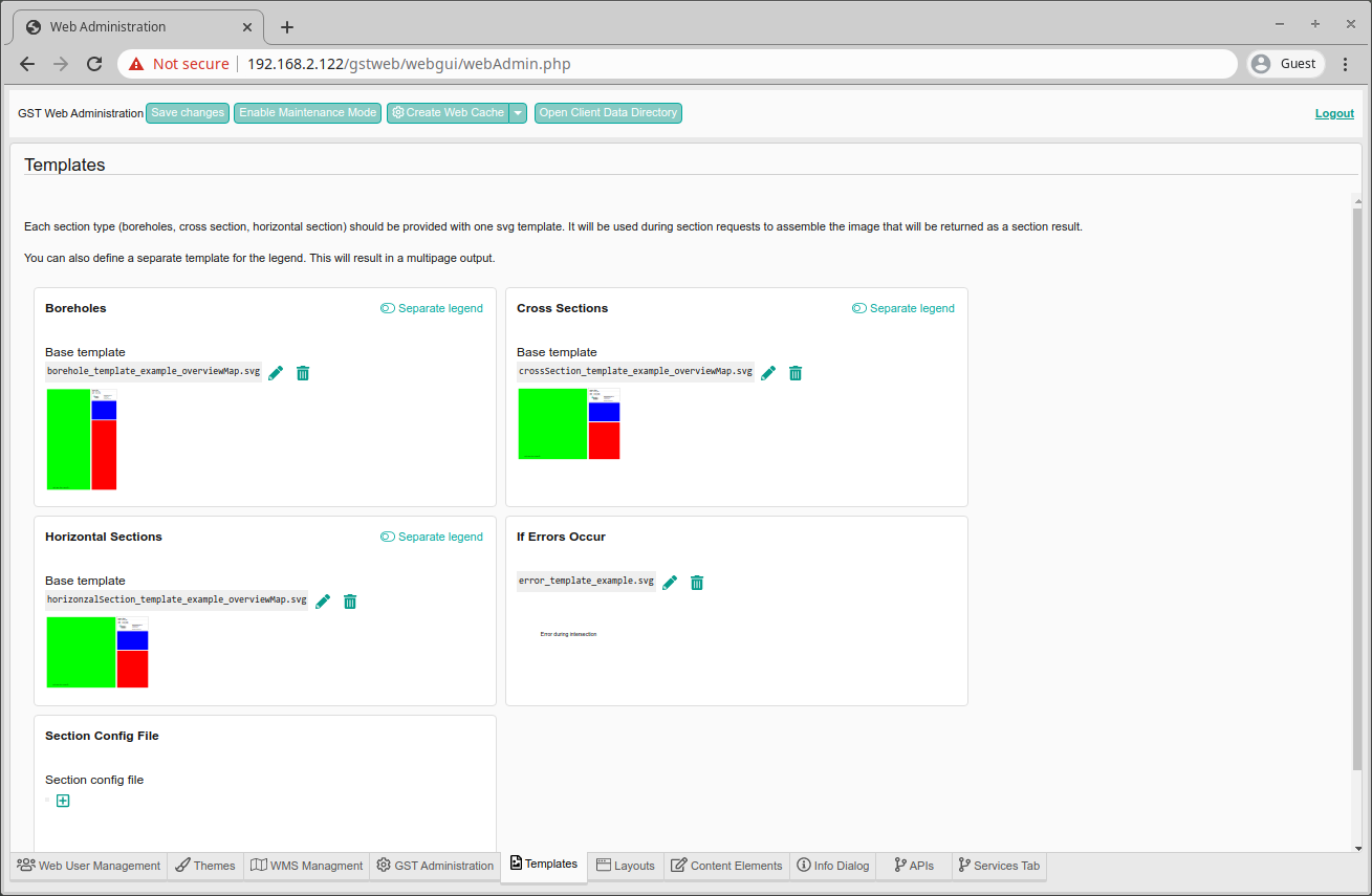
- We have separated the template preview which makes the handling of the templates easier by allowing to preview them
- We have added a shortcut to the file manager and the client data which allows to handle your custom data in an easier way by dragging and dropping right from your desktop

- A new button allows to control the caching. This makes GST Web load faster and display the features faster
GUI Improvements
We added more tools to the GUI:
- allow the user to control the zoom direction and zoom speed since this highly depends on the used mouse
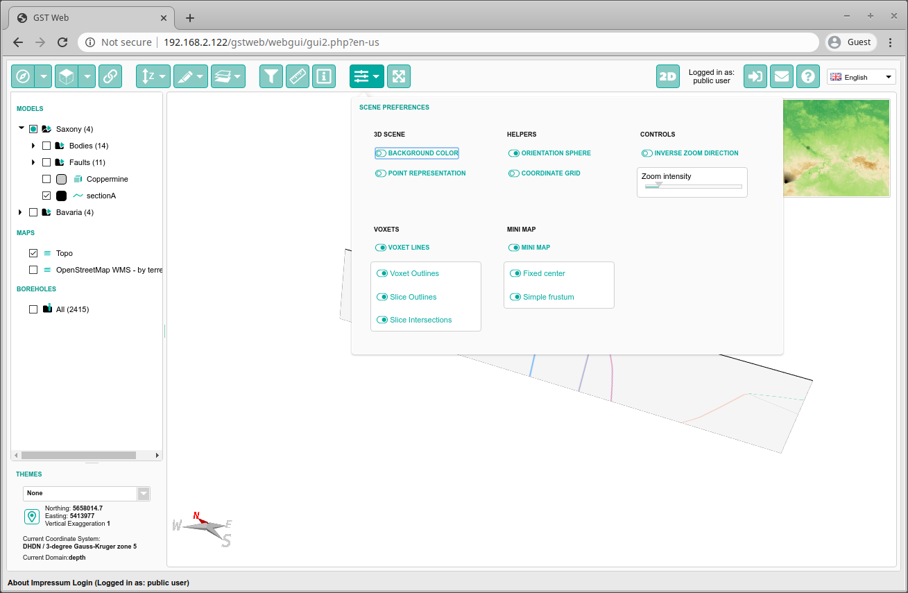
- the center of rotation (the sphere in the middle of the screen) stays at a fixed size
- set points for measurement and information tool stay at a fixed size
- a query tool has been added
- the users can drag the camera in the minimap to move around easier within the scene
- users can search for an address and, if activated, even for cadastres
- you now can isolate single features
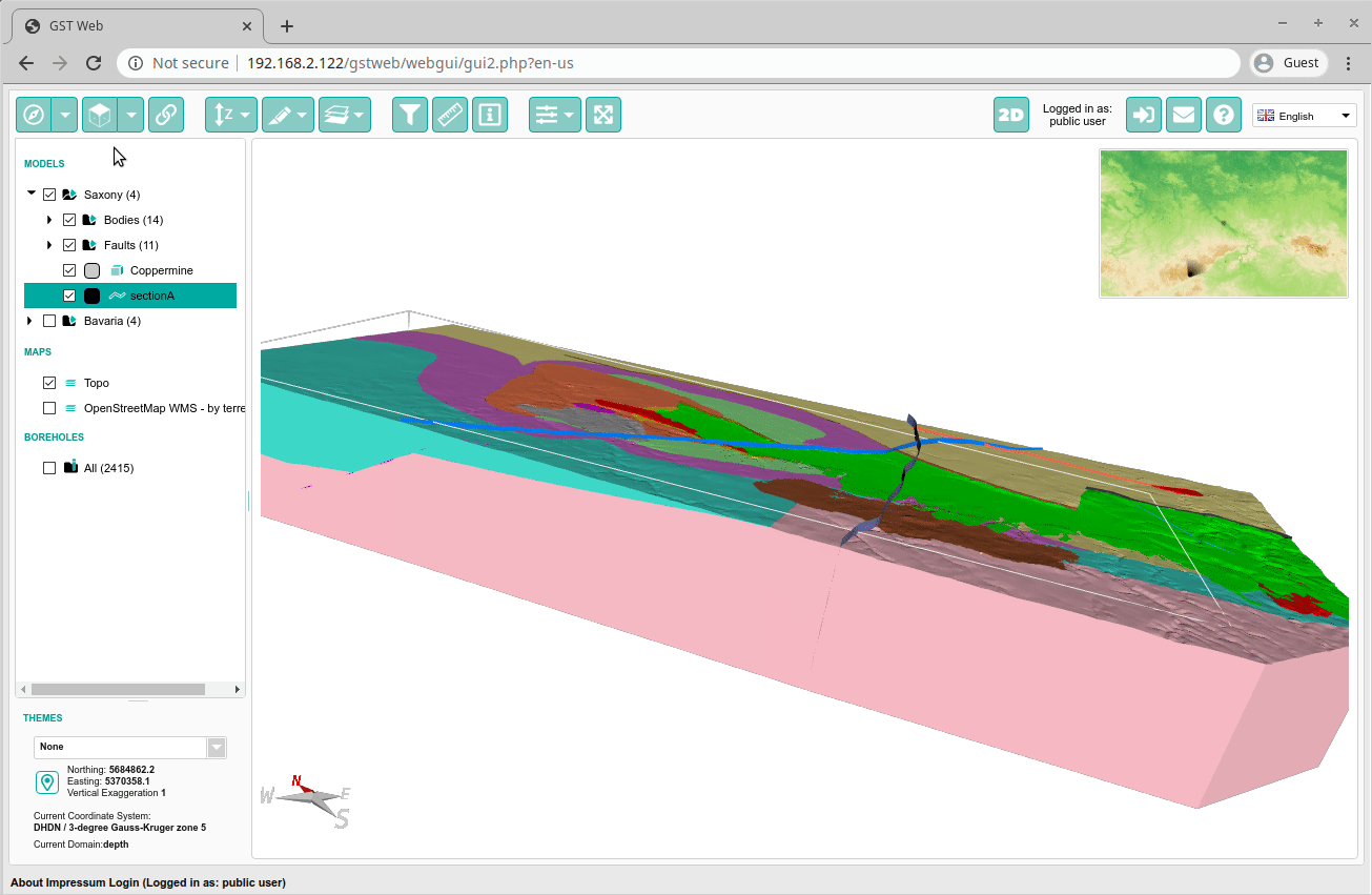
Models of Interest
In order to reduce the amount of models a user can see on the initial opening of GST Web we introduced the model interest feature which allows to filter the overall Model tree. This allow to focus on certain aspects of a model or to focus one single model out of several.
Note: This cannot be used as security feature. The whole Model tree is still there and only visually hidden from the end user.
You can activate this feature by adding e.g. ?filter=Saxony.Bodies to the URL in your browsers address bar. Thus GST Web will only display the Model element Bodies from the model Saxony. 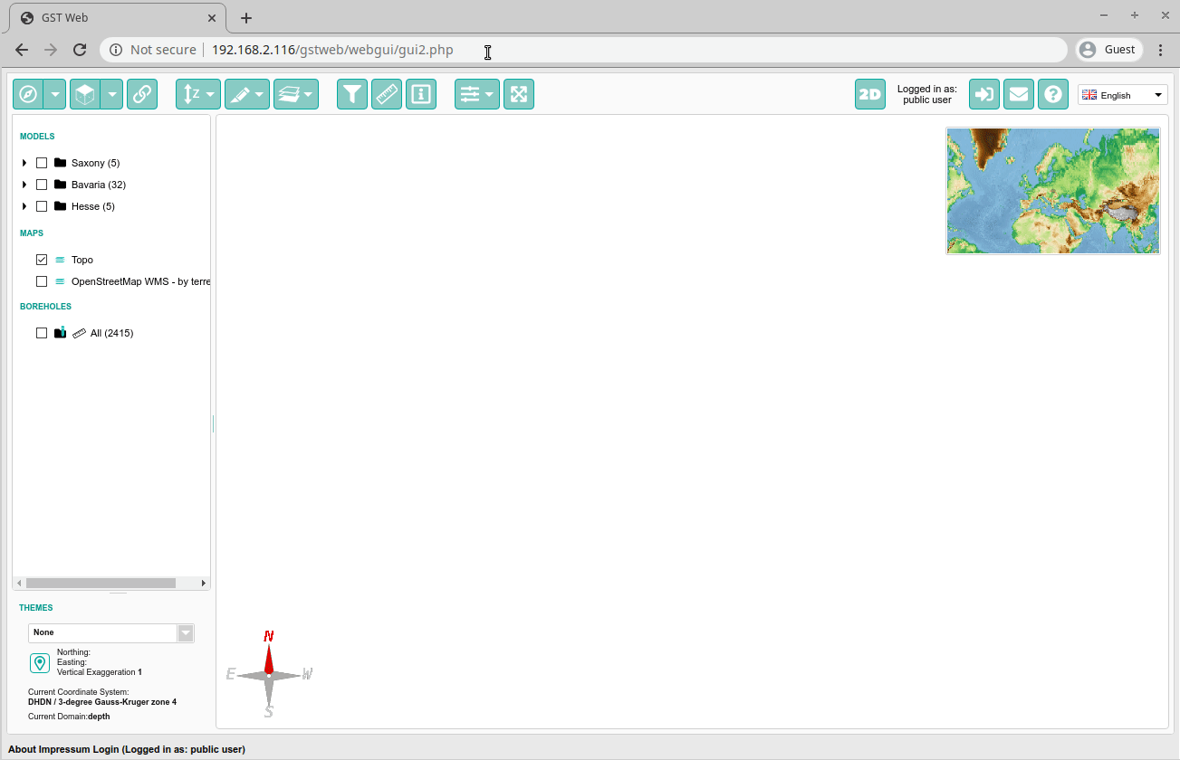
You can also combine this feature with viewlinks by adding &filter=true to the URL. This will display all elements contained within that particular viewlink. 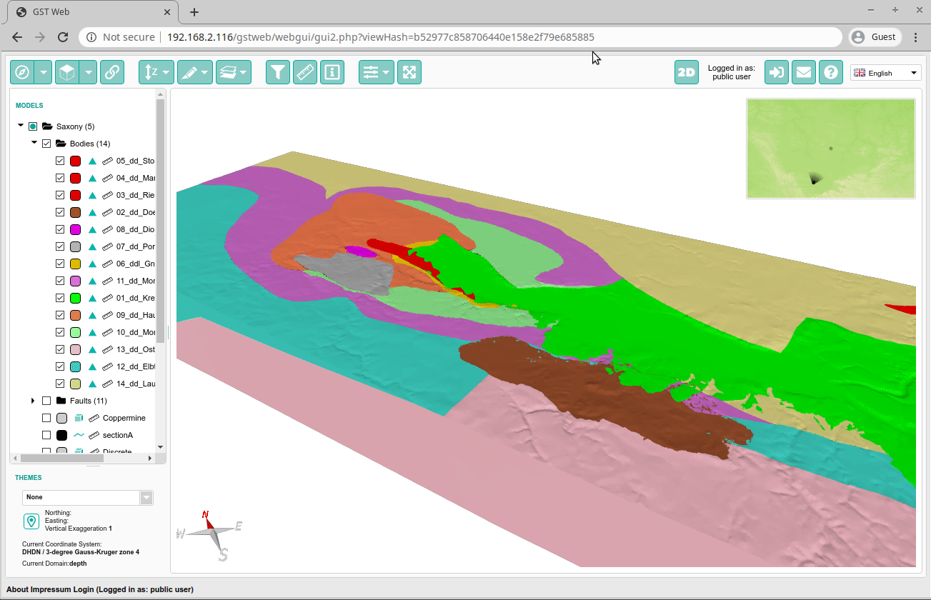
Note: Features will not be affected by the filter.
Query Tool
Some of our customers have many thousands of features prepared to be viewed. Despite the ordering in Models and also the filter capability users may want to find features quickly within the model tree. Due to the new query tool this can be achieved easily:
- click on the filter icon in the top button bar
- within the new dialog you can select to filter all features or only the features that are already displayed within the scene
- you can choose any feature attribute and create queries
- the operators are restricted to each property’s data type
- you can add multiple conditions and combine them with “AND”, “OR” or “XOR”
- you will see a preview of your current filter as a tree and you can click “Show in 3D scene” to display the filtered features directly in the 3d scene
- you can save the filter result as a new tree below the model tree on the right hand side.
WMS Refinement
Once you displayed an additional map within the 3d scene the map will be refined automatically depending on your zoom level. This even works for draped maps: 
Address Search
In order to make it easier to locate a particular address within the scene we have implemented an address search. You can reach it by clicking on the map marker icon at the bottom left of GST Web. This will open a dialog where you can enter either:
- coordinates to jump to
- an address to jump to.
The addresses are priotized according the current model. This means that results within the area are shown before results outside of the model area. 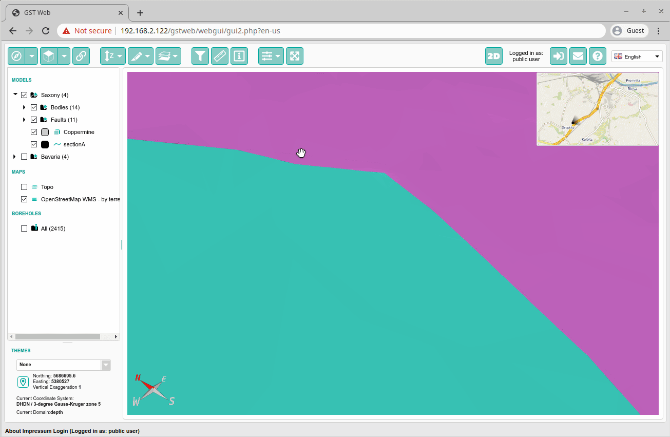
Cadastre Search
If provided a WFS cadastre search can be used to search for parcels and jump to them directly. As of now the implementation uses the cadastre search of the Hessian Agency for Nature Conservation, Environment and Geology and therefore is not activated for the wider public. We would love to make this service available for your GST Web instance. Please do not hesitate to contact us! 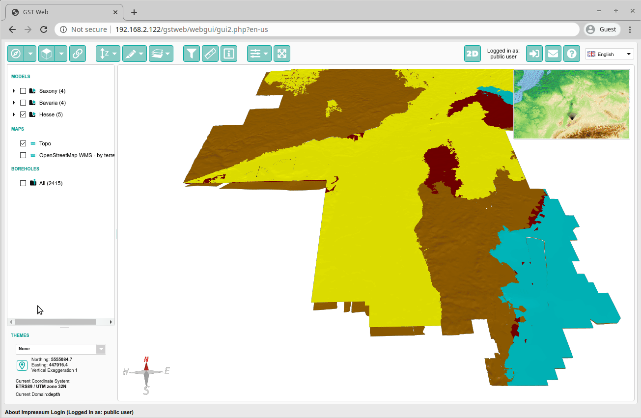
Discrete Color Maps
Since we added support for discrete color maps you can also display them in 3d. If the legend does not fit the space in lower right of the scene a distinct dialog can be opened to display the complete legend. 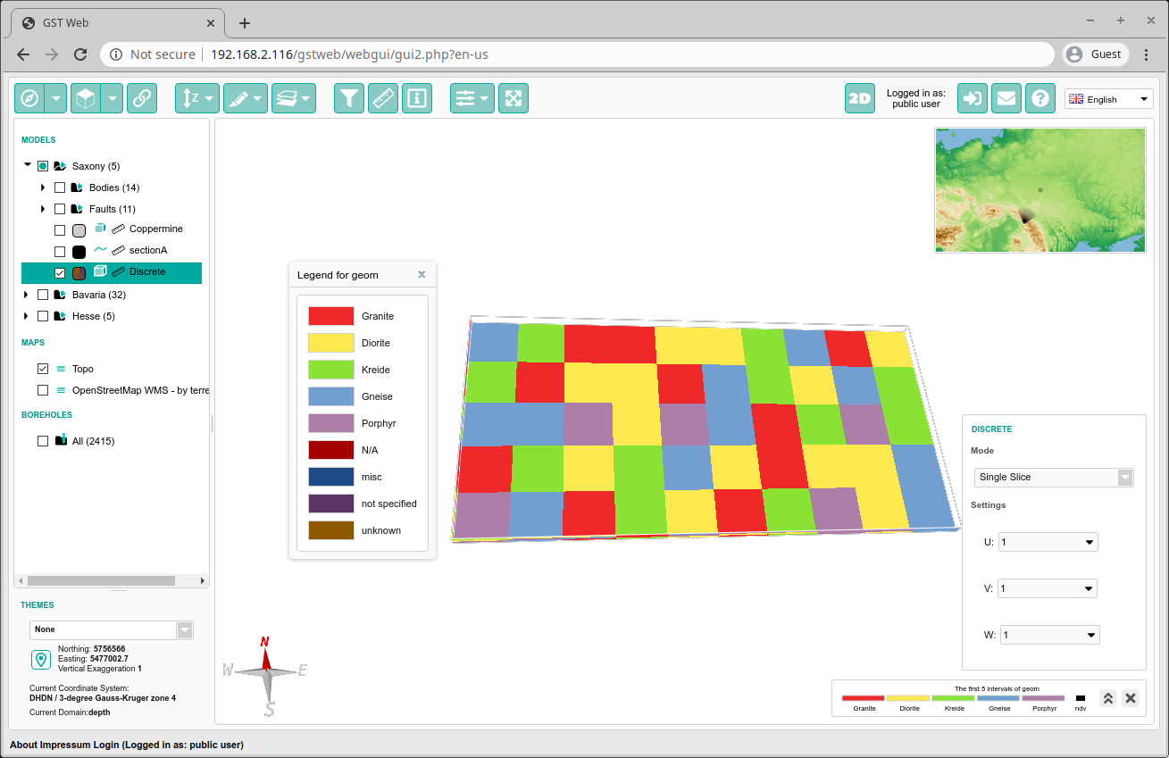
GST Boreholes
With the release of GST Web 3.4 we also introduced the support for a borehole database. In order to do so we implemented a completely new GST Borehole service that is able to use a more or less arbitrarily borehole database and provide its data to GST Web.
Boreholes can be displayed in 3d with their real 3d path. This means that even directional boreholes can be displayed. Currently GST Web supports to display either Stratigraphy or Petrography. Moreover, the user can click on the single segments of a borehole and get more information about them. 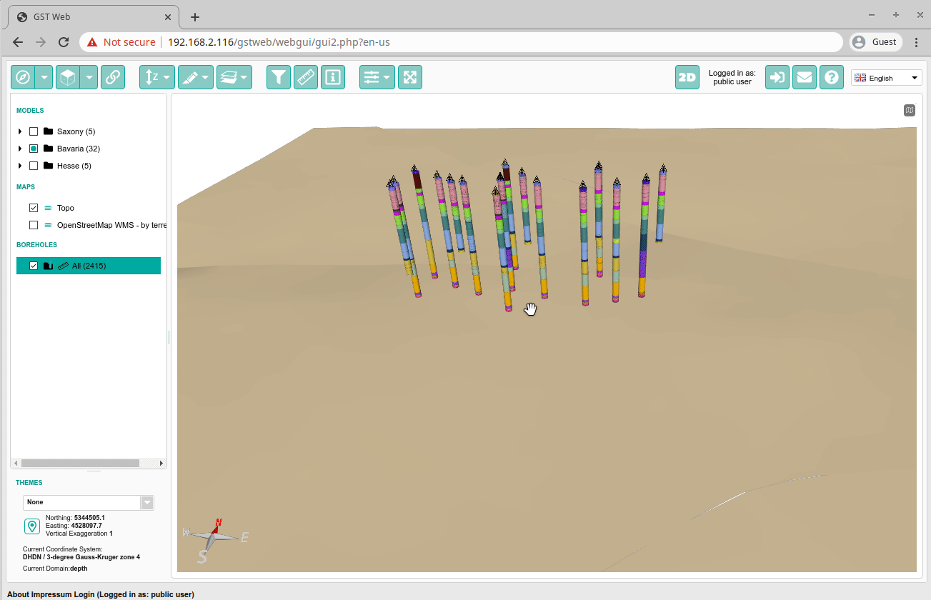
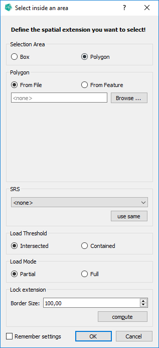
Query Feature per polygon
We added the option to use a simple polygon as Selection Area for downloading Features.
- In Download Option, renamed “Inside a Box…” -> “Inside an Area…”.
- Selection Area as Box (like before) or as Polygon (new).
- Polygon can be selected from file (currently gocad pline and shape) or from an existing Line Feature.
- Per convention, we take the first polygon of a file.
- If a polygon isn’t closed (start point = end point) we close it before usage.
- New Options Load Threshold and Load Mode.
- Load Threshold defines when a feature is accepted by a Selection Area.
- Intersected: Any Feature that intersects with the Selection Area will be accepted.
- Contained: Only Features completely inside the Selection Area will be accepted.
- Load Mode defines how an accepted feature is loaded.
- Partial: Only the part of the Feature inside the Selection Area will be loaded.
- Full: The complete Feature will be loaded.
- Load Threshold defines when a feature is accepted by a Selection Area.
Change Owner of MoMa Element or Feature Class
You can now change the owner of MoMa Elements and Feature Classes.
- Option “Chown Selected Classes…” in the context menu of a Feature Class.
- Option “Chown Model(s)/Element(s)/Unit(s)…” is available in the context menu of a MoMa Element in the right side view of the Models tab.
- It is possible to change the Owner of multiple items at once.
Snapshot of Feature Class
We added the option to create a Snapshot of a Feature Class. A Feature Class Snapshot is a copy of the Feature Class itself with all Features, Attribute and Property values in the current version.
- Option “Snapshot Feature Class” in the context menu of a Feature Class.
- Choose Owner and name of Snapshot.
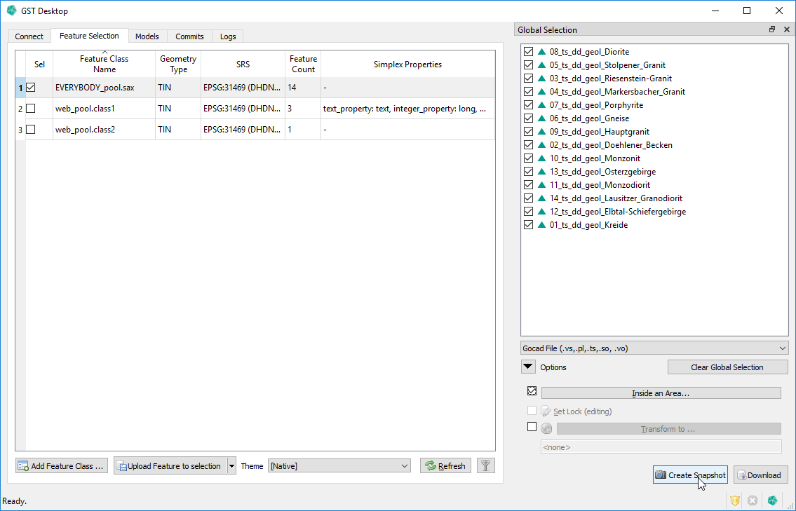
Snapshot of Feature Selection
Snapshot of Feature Selection combines the Snapshot of a Feature Class with a selection of Features and the option to limit the Features extent with the help of a Selection Area.
- Button “Create Snapshot” in the Global Selection pane.
- Features are affected by the settings in “Inside an Area”. This means Features will only be copied if accepted by the Selection Area with Load Threshold setting. The features shape will be affected by the Load Mode setting. Everything else behaves the same as “Snapshot of Feature Class”.
- Note: This option is currently only available if the Features in the Global Selection all belong to the same Feature Class.
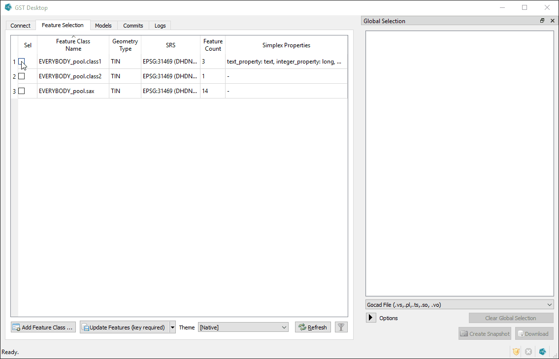
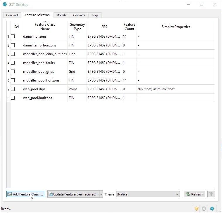
Improve Feature and Feature Class View
The Feature and Feature Class view can now both be sorted by column. We also added various filter options to both views.
- The Feature Class view can be sorted by a column (already available for the Feature view).
- The Feature Class view can be filtered by owner, name, geometry type and/or SRS.
- The Feature view can be filtered by name, lock status, hull status and/or a user column.
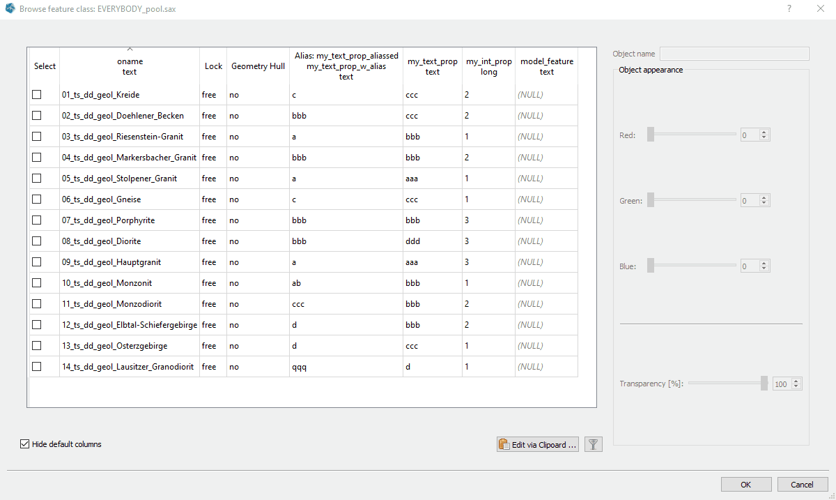
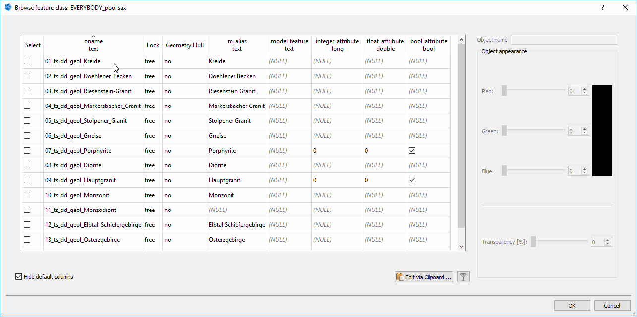
Color Maps for discrete Feature Properties
You can now create Color Maps for discrete property values. The previous version only worked with continuous values and did interpolated between values and colors, if required. A discrete Color Map maps values directly to a color, no interpolation will be done.
- New Color Map type for discrete Feature Properties.
- Discrete Property types are bool, integer and string.
- Can be created and edited from Color Map dialog. Feature Class context menu -> “Simplex Properties” -> “Edit Color Maps…” or context menu -> “Simplex Properties” -> “property-name-with-discrete-type”.
- Entries can be added either one by one or with the clipboard tool.
Alias for Feature names
A new option for defining alias names for Feature. The names of uploaded features often technical and not quite fit for a general audience. For this you can now define alias names that will be used in GST Web and Intersection images instead of the technical name.
- The Feature Alias can be stored in a special Feature Attribute named “m_alias” with type text.
- If a Feature has a value for this Attribute, the alias is used in GST-Web (including Intersections) in any place where the Feature name is shown. If no value is set or the Attribute is not present, the normal Feature name is used.
- Note: Currently this Feature Attribute has to be added manually (either during creation or afterwards with the edit option).
Grid Shift Files in SRS Definitions
We added support for grid shift files in SRS definitions.
We deploy the standard grid shift file set proj-datumgrid, which includes the Beta2007 grid for the DE_DHDN / GK_3 -> ETRS89 / UTM transformation.
See here for more information regarding the Beta2007 transformation.
Transform SRS of Feature Class
A new option to transform the SRS of a Feature Class.
- Option “Transform SRS of Feature Class” in the context menu of the selected Feature Class.
- Will create a new Feature Class with all Features in the new SRS, Attribute and Property values are copied.
- MoMa Tree entries will be updated to reference the transformed Feature.
- The old Feature Class will be kept as backup with a suffix “_not_transformed” (can be safely deleted).
![]()
![]()
Features with Z-Axis Domain in Time
You can now store Feature where the z-axis domain is time (ms).
- New Option “Z-Axis Domain” in Create Feature Class dialog with options “Height” (the previously only option) or “Time”.
- Updated our Gocad format routines to correctly read and write Features with a time z-axis domain.
- Web and Intersection will display the time z-value unit as ms, where previously we only used m.
Smaller Improvements
Change Attribute Values for multiple Features
- Option “Change Attribute Values for highlighted Features…” in the context menu when highlighting two or more Features in the Feature view.
- Allows to set the Color and/or Attribute Values of all highlighted Features to the same value.
- Only checked Attributes will be changed, unchecked once keep their current values.
Clear Global Selection
- New button “Clear Global Selection”.
![]()
![]()
Show more Information
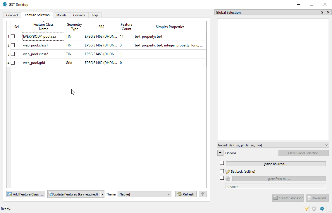
- The Feature Class view has a new column “Feature Count” which displays the number of Features in the Feature Class.
I3S Format
- You can now download TINs in the I3S format which allows you to integrate your models with ArcGIS Pro.
More placeholders in templates
- In order to make the templates even more customizable we have added more placeholders allowing you to do control the size of the section or borehole image more detailed.
Print legend on multiple pages
- If you have a particular long legend for a borehole or cross-section we will no print it on a second page